 Beyond Coordinates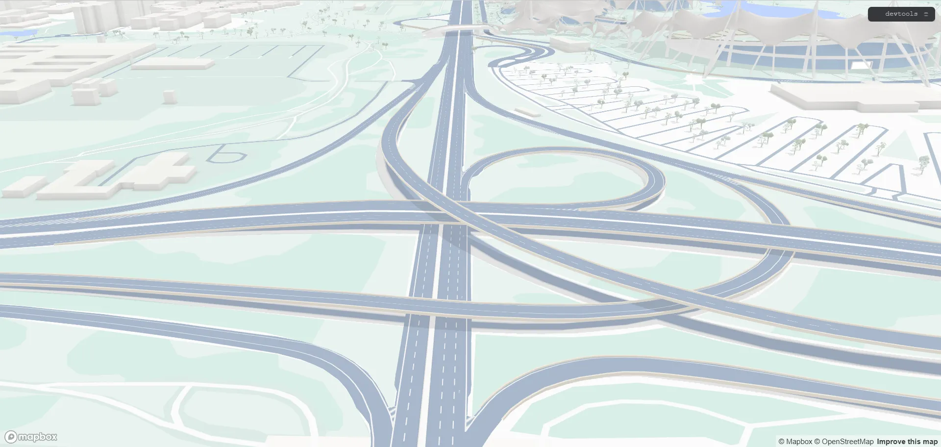
Recent Mapbox GL JS releases added 3D rendering for road interchanges. With lane-level HD map data, Mapbox can represent interchanges, elevated roads, tunnels, hatched areas, and related features. This article examines the implementation from the perspectives of styling, data, and rendering.
Preview
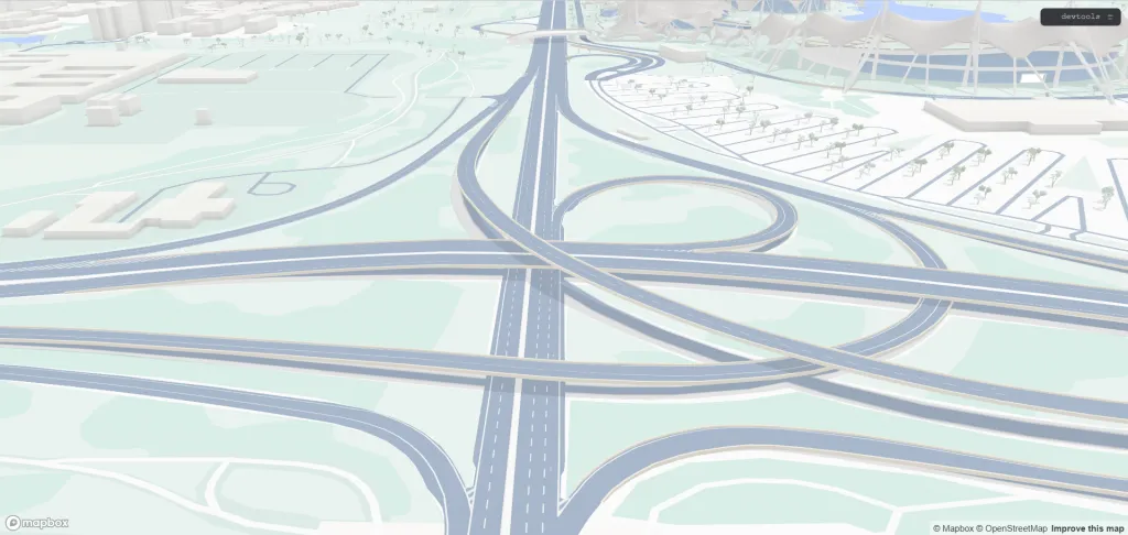
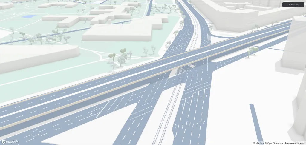
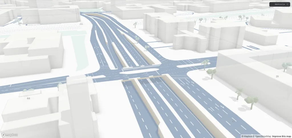
The dataset is available through this preview, which worked when this article was published but may not remain public. The sample covers Munich, Germany; perhaps the HD map feature was developed for BMW.
Data Model
The preview reveals how the HD map dataset is organized. It is delivered as Mapbox Vector Tiles (MVT), although it is not yet clear whether hd-roads adheres strictly to the current MVT specification or carries additional data. It contains the following main layers.
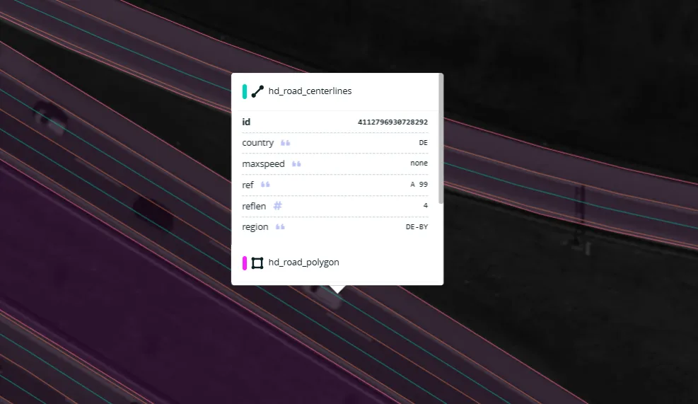
hd_road_centerlines
The centerline of each traffic lane. This layer is not used for rendering and excludes emergency lanes; it is better suited to displaying navigation routes.
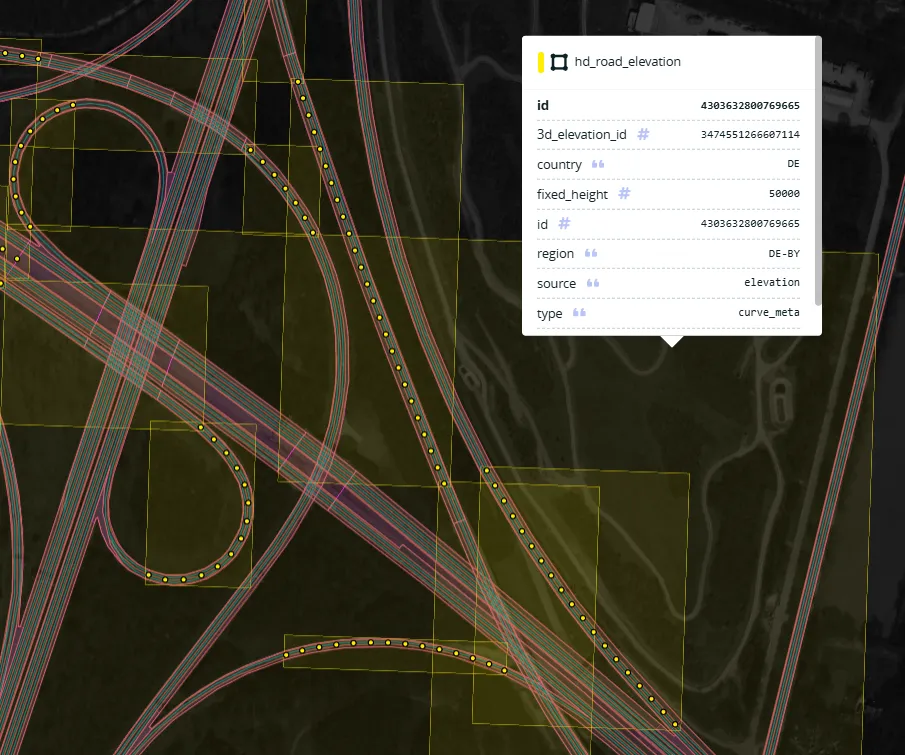
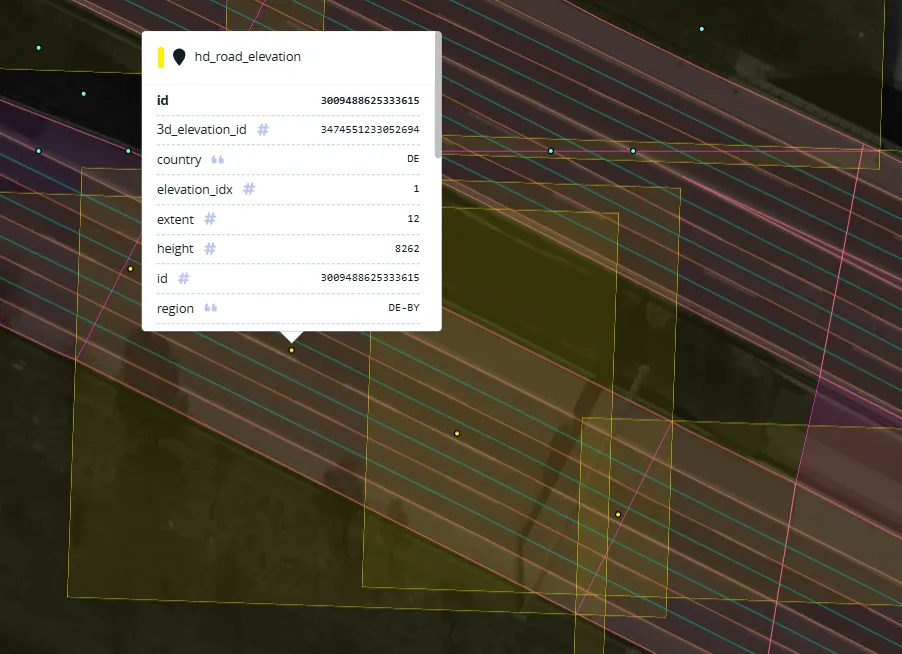
hd_road_elevation
This unusual layer contains both polygons and points and is clearly not rendered directly. Its name suggests that it carries road-elevation information; its exact role is discussed later.
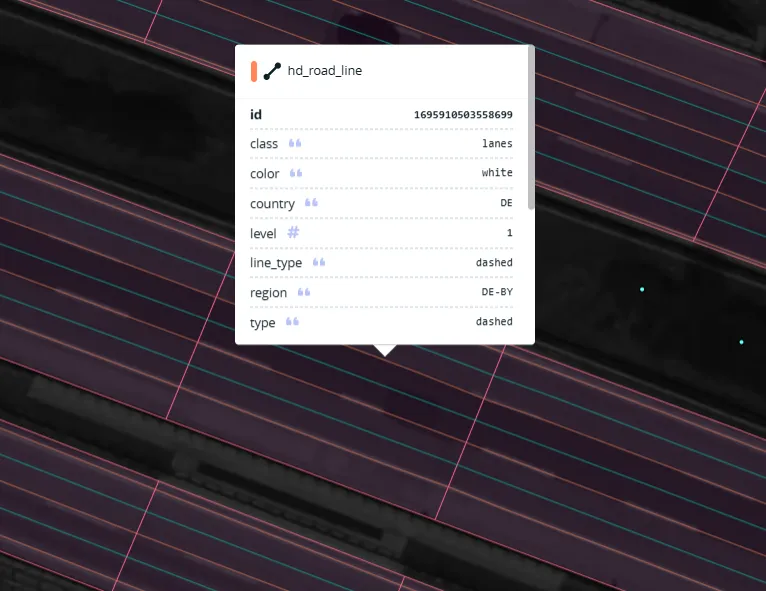
hd_road_line
Lane boundary lines. Adjacent lanes share one boundary feature, and emergency-lane boundaries are included. They can be rendered as solid or dashed lines.
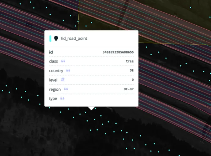
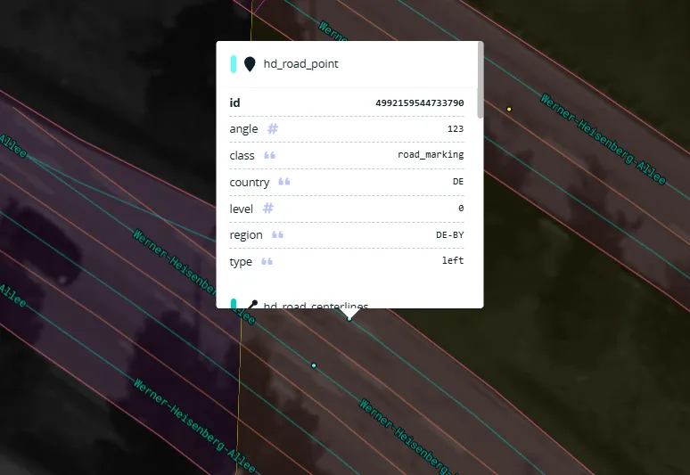
hd_road_point
This layer contains several point-feature types, including roadside vegetation and road symbols.
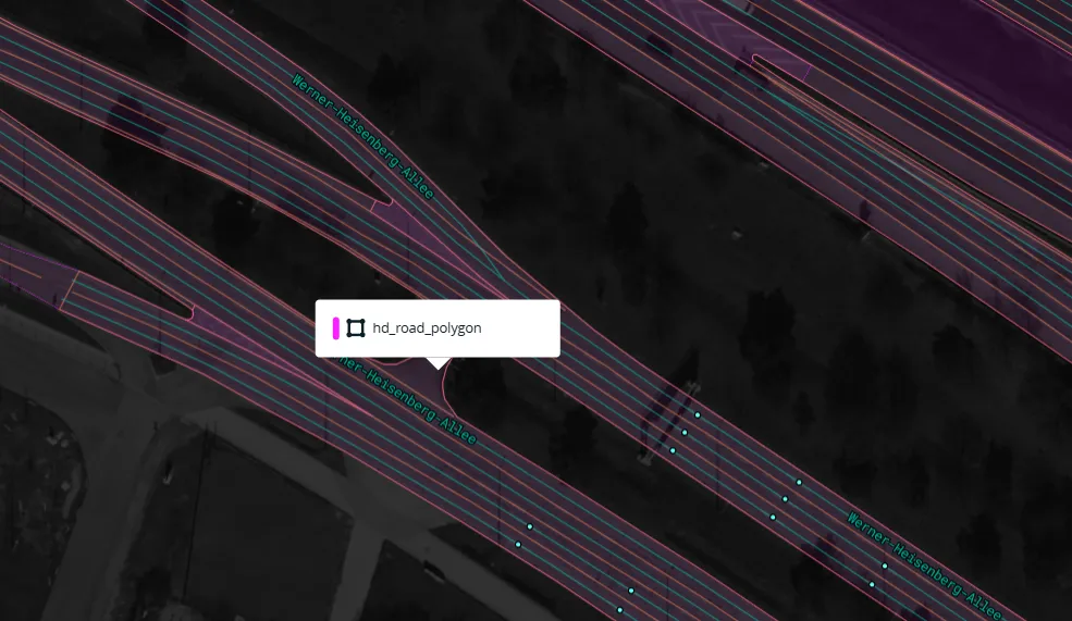
hd_road_polygon
This polygon layer covers traffic lanes, emergency lanes, hatched areas, and other road surfaces. In simple terms, it contains nearly everything directly associated with the road except the trees.
Map Style
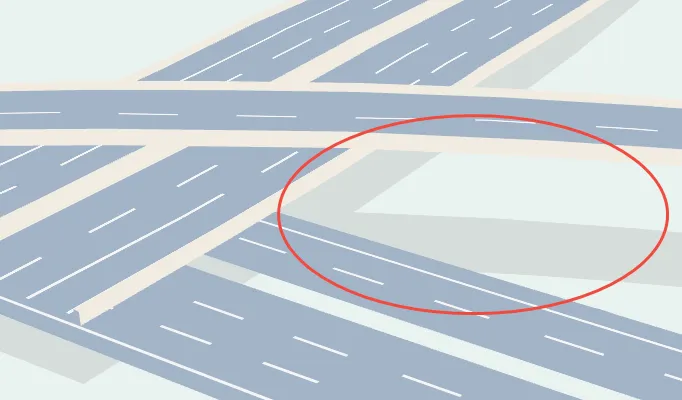
The full example is available in debug/3d-intersections.html. For implementation analysis, the more focused cases in the test directory are easier to study. One test style produces the following output:
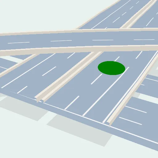
The corresponding style is shown below, with unrelated sections omitted:
{
	"version": 8,
	"sources": {
		"hd-roads": {
			"type": "vector",
			"tileSize": 512,
			"maxzoom": 18,
			"tiles": ["local://tiles/3d-intersections/{z}-{x}-{y}.mvt"]
		},
		"geojson": {
			"type": "geojson",
			"data": {
				"type": "FeatureCollection",
				"features": [
					{
						"type": "Feature",
						"properties": {
							"zLevel": 1
						},
						"geometry": {
							"type": "MultiPoint",
							"coordinates": [[11.5406, 48.1763]]
						}
					}
				]
			}
		}
	},
	"layers": [
		{
			"id": "fake-road-shade",
			"type": "fill",
			"source": "hd-roads",
			"source-layer": "hd_road_polygon",
			"filter": [
				"all",
				["match", ["get", "class"], ["road", "bridge"], true, false]
			],
			"paint": {
				"fill-color": "rgb(214, 221, 219)"
			}
		},
		{
			"id": "road-base",
			"type": "fill",
			"source": "hd-roads",
			"source-layer": "hd_road_polygon",
			"filter": ["all", ["match", ["get", "class"], ["road"], true, false]],
			"layout": {
				"fill-elevation-reference": "hd-road-base"
			},
			"paint": {
				"fill-color": [
					"interpolate",
					["linear"],
					["zoom"],
					16,
					"hsl(212, 25%, 80%)",
					18,
					"hsl(212, 25%, 71%)"
				]
			}
		},
		{
			"id": "road-base-bridge",
			"type": "fill",
			"source": "hd-roads",
			"source-layer": "hd_road_polygon",
			"filter": ["all", ["match", ["get", "class"], ["bridge"], true, false]],
			"layout": {
				"fill-elevation-reference": "hd-road-base"
			},
			"paint": {
				"fill-color": [
					"interpolate",
					["linear"],
					["zoom"],
					16,
					"hsl(212, 25%, 80%)",
					18,
					"hsl(212, 25%, 71%)"
				]
			}
		},
		{
			"id": "road-hatched-area",
			"type": "fill",
			"source": "hd-roads",
			"source-layer": "hd_road_polygon",
			"filter": [
				"all",
				["match", ["get", "class"], ["hatched_area"], true, false]
			],
			"layout": {
				"fill-elevation-reference": "hd-road-markup"
			},
			"paint": {
				"fill-opacity": ["interpolate", ["linear"], ["zoom"], 15, 0, 16, 1],
				"fill-pattern": [
					"match",
					["get", "color"],
					["yellow"],
					"hatched-pattern-yellow",
					"hatched-pattern"
				]
			}
		},
		{
			"id": "solid-lines",
			"type": "line",
			"source": "hd-roads",
			"source-layer": "hd_road_line",
			"filter": [
				"all",
				["match", ["get", "class"], ["lanes"], true, false],
				[
					"match",
					["get", "line_type"],
					["solid", "solid_half_arrow", "half_arrow_solid", "arrow_solid"],
					true,
					false
				]
			],
			"layout": {
				"line-elevation-reference": "hd-road-markup"
			},
			"paint": {
				"line-color": [
					"match",
					["get", "color"],
					["yellow"],
					"hsl(54, 100%, 65%)",
					"hsl(0, 0%, 96%)"
				],
				"line-width": [
					"interpolate",
					["exponential", 1.5],
					["zoom"],
					15,
					0,
					18,
					1.5,
					19,
					3,
					22,
					10
				]
			}
		},
		{
			"id": "double-lines",
			"type": "line",
			"source": "hd-roads",
			"source-layer": "hd_road_line",
			"slot": "",
			"filter": [
				"all",
				["match", ["get", "class"], ["lanes"], true, false],
				["match", ["get", "line_type"], ["double"], true, false]
			],
			"layout": {
				"line-elevation-reference": "hd-road-markup"
			},
			"paint": {
				"line-color": [
					"match",
					["get", "color"],
					["yellow"],
					"hsl(54, 100%, 65%)",
					"hsl(0, 0%, 96%)"
				],
				"line-width": [
					"interpolate",
					["exponential", 1.5],
					["zoom"],
					15,
					0,
					18,
					1.5,
					19,
					3,
					22,
					10
				],
				"line-gap-width": 2
			}
		},
		{
			"id": "dashed-lines",
			"type": "line",
			"source": "hd-roads",
			"source-layer": "hd_road_line",
			"filter": [
				"all",
				["match", ["get", "class"], ["lanes"], true, false],
				[
					"match",
					["get", "line_type"],
					[
						"dashed",
						"arrow_dashed",
						"long_dashed",
						"short_dash",
						"solid_dashed"
					],
					true,
					false
				]
			],
			"layout": {
				"line-elevation-reference": "hd-road-markup"
			},
			"paint": {
				"line-color": [
					"match",
					["get", "color"],
					["yellow"],
					"hsl(54, 100%, 65%)",
					"hsl(0, 0%, 96%)"
				],
				"line-width": [
					"interpolate",
					["exponential", 1.5],
					["zoom"],
					15,
					0,
					18,
					1,
					19,
					3,
					22,
					6
				],
				"line-dasharray": [
					"step",
					["zoom"],
					["literal", [14, 14]],
					20,
					["literal", [18, 18]]
				]
			}
		},
		{
			"id": "circle",
			"type": "circle",
			"source": "geojson",
			"layout": {
				"circle-elevation-reference": "hd-road-markup"
			},
			"paint": {
				"circle-radius": 40,
				"circle-color": "green",
				"circle-pitch-alignment": "map"
			}
		}
	]
}
Together with several related styles, this file shows that a 3D interchange is assembled from the following layers.
fake-road-shade
This layer renders the road-surface polygons as a simple shadow—a clever and inexpensive effect.
road-base, road-base-bridge
The gray road surfaces come from road-base and road-base-bridge. Both use the road polygons from the source.
road-base lies on the ground as an ordinary 2D polygon. road-base-bridge is elevated in 3D, with fill-elevation-reference set to hd-road-base in its layout. This property is the key to the 3D effect.

road-hatched-area
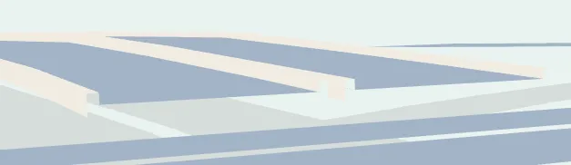
Hatched road areas are rendered with fill-pattern, which requires a striped texture and does not provide control over the pattern’s orientation.

solid-lines, double-lines, dashed-lines
Lane dividers, lane-edge markings, and similar linework.
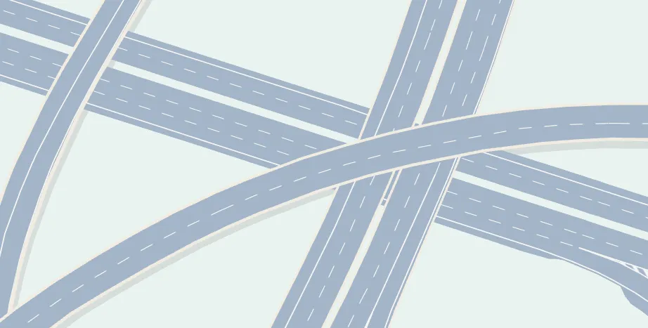
The style also contains lane-direction indicators, tunnels, and other features that follow patterns similar to the layers above.
Rendering Implementation
After examining the style’s sources and layers, the most unusual pieces are the hd_road_elevation dataset and the various *-elevation-reference properties.
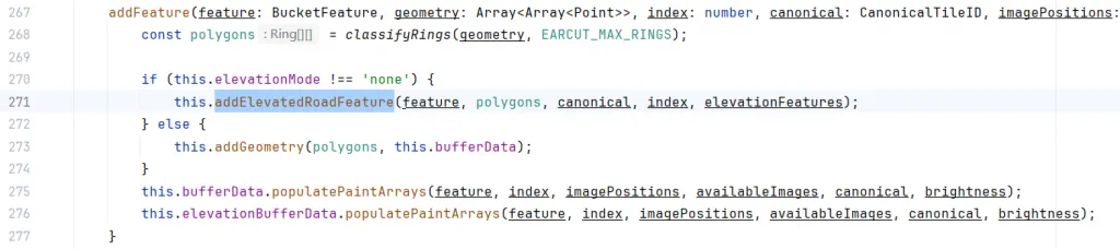
In src/data/bucket/fill_bucket.ts, the bucket reads fill-elevation-reference into elevationMode.
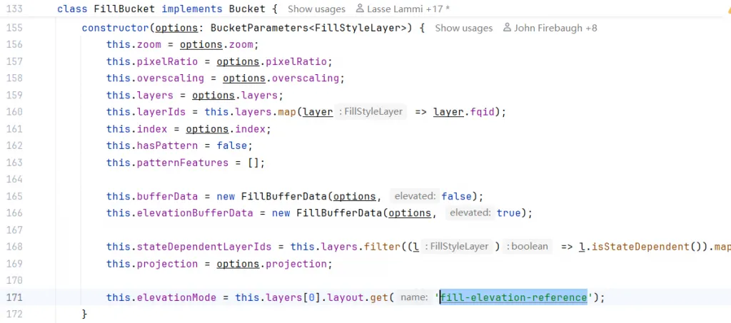
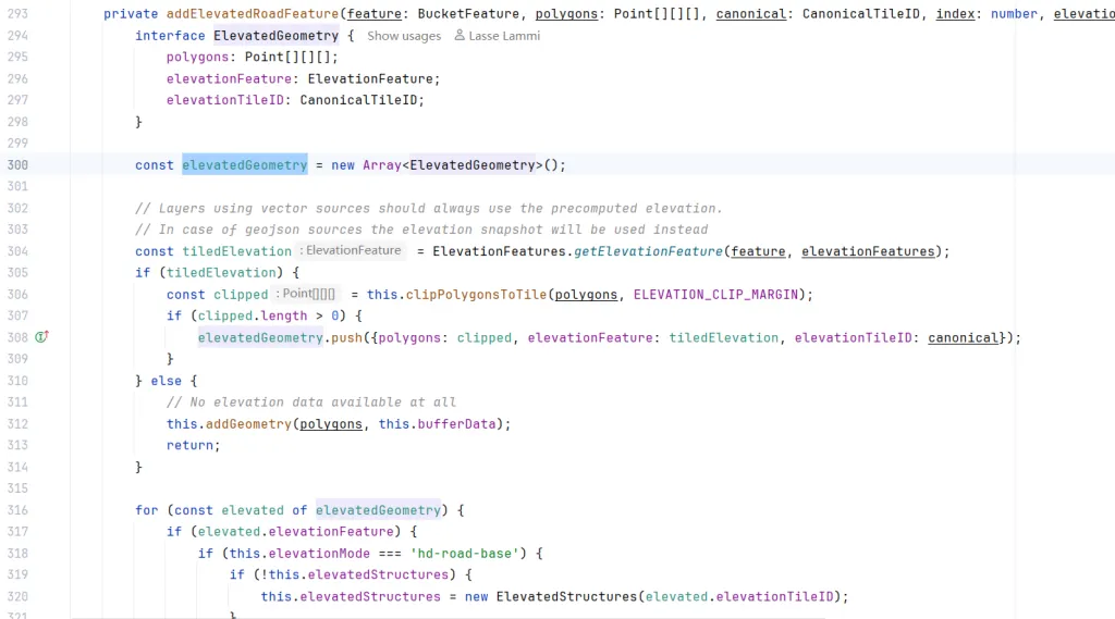
For a source whose elevationMode is not none, geometry is created from elevationFeatures.
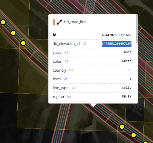
Not every elevation feature participates in a given feature’s calculation. Around line 304, the code uses 3d_elevation_id to retrieve the corresponding tiledElevation data.
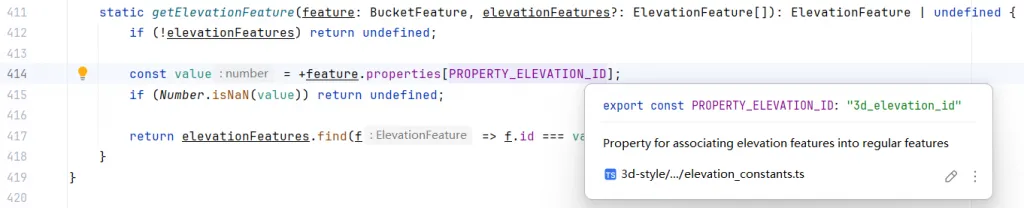
Returning to the data model, hd_road_line joins to hd_road_elevation through 3d_elevation_id and obtains its height data from that layer.
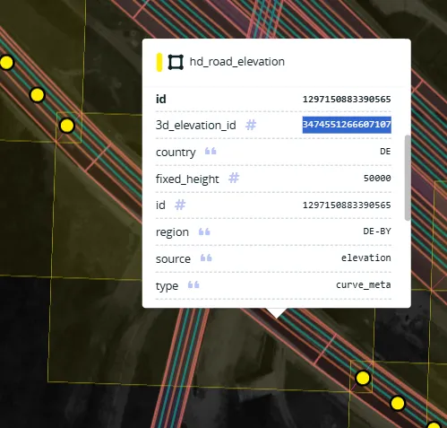
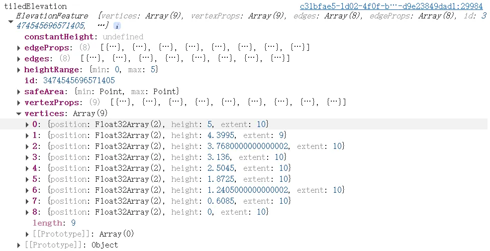
An individual elevationFeatures record contains both point coordinates and heights in its vertex array.
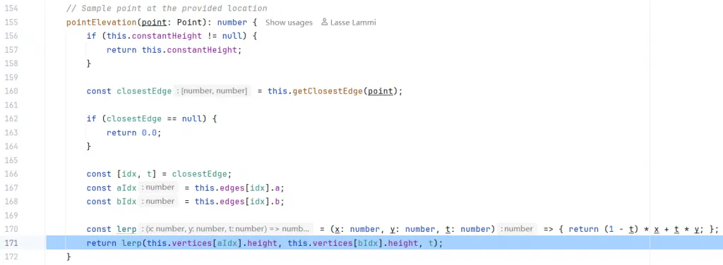
In 3d-style/elevation/elevation_feature.ts, the code calculates the height at a requested position with linear interpolation.
Summary
Mapbox v2 formally introduced terrain rendering and a 3D elevation foundation for map overlays. Point, line, and polygon features could then be positioned in three dimensions. Mapbox’s HD map visualization builds on similar mechanisms, with the construction of hd_road_elevation serving as the core of accurate 3D road reconstruction.
I look forward to seeing what Mapbox builds next for HD map visualization.